DEFRA CONSULTATION
Moor Burning Consultation
The main thrust of the proposed changes is to increase the area where burning requires a licence
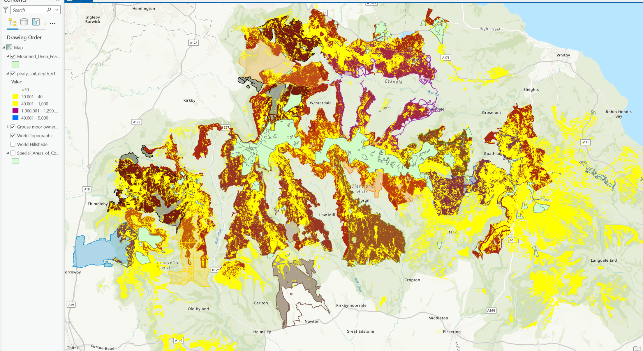
The map below shows the estate boundaries in a dark colour.
This is overlaid with the new areas as pale yellow
On top of this is the deep peat areas in the current legislation in pale green
The map below shows the estate boundaries in a dark colour.
This is overlaid with the new areas as pale yellow
On top of this is the deep peat areas in the current legislation in pale green
The current burning-restricted area is therefore the pale green area and the proposed area has been extended to include the pale yellow area
**DEFRA Consultation**
Now Closed
Please read the government's New proposals to ban heather burning on peatland to protect air, water and wildlife and DEFRA's consultation to modify the regulations
We have collated available data for a single day's burn (PMs, wind direction, satellite imagery) and reported on it here
It shows more than a dozen burn sites visible from space with PM2.5s in Danby Dale peaking over 350µg/m3
It shows more than a dozen burn sites visible from space with PM2.5s in Danby Dale peaking over 350µg/m3
